How do you navigate a vertical metropolis where "Up" is the new "North"?
I developed a multi-sensory navigation strategy that coordinates 200,000 residents, commuters, and tourists through a car-free, 3D volume, making the architecture itself the interface.
My Role
Strategic Lead / Experience Designer
(Contracted via N+P Innovation Design)
Project Background
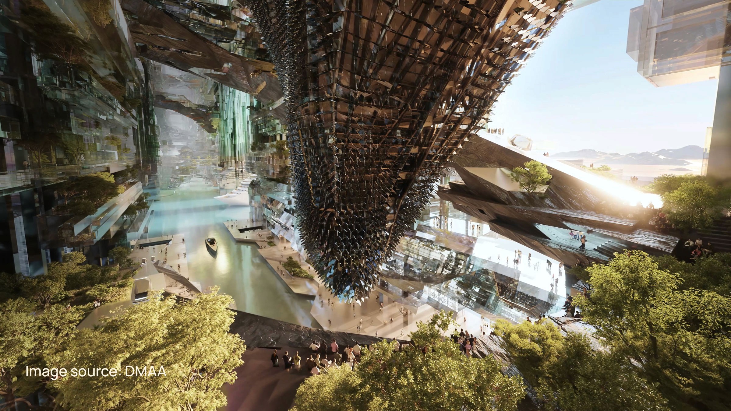
Developed the navigational logic for the Hidden Marina modules of THE LINE (NEOM). The project focused on translating the architectural concept of "Zero Gravity Urbanism" into a human-centric wayfinding system that serves 200,000 residents and millions of incoming tourists in a vertical, car-free metropolis.
Industry
Smart Cities & Urban Mobility
Duration
8 months
!
Disclaimer: This case study examines the strategic methodology and publicly available architectural constraints of The Line. Visuals presented are schematic interpretations and do not represent final proprietary designs.
The Problem
In The Line, time is the only metric that matters. The city guarantees a 5-minute walk to amenities and a 20-minute commute across town—a promise that turns navigation into a high-stakes puzzle. Because in this vertical metropolis, if the flow stops, the city stops working.

The cities we live in
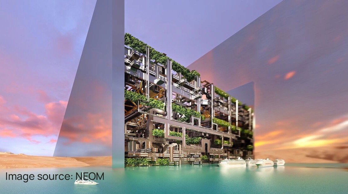
City of the future

The Research
We analyzed urban planning and wayfinding concepts, recognizing that standard horizontal navigation principles prove insufficient in vertical metropolises.
Navigability relies on five elements: paths, edges, districts, nodes, and landmarks. In a vertical city, Landmarks and Nodes must exist on the Z-axis to prevent spatial disorientation.

Humans build mental maps to navigate. In repetitive, modular structures, distinct visual cues are required to prevent corridor fatigue and aid memory retention.
We investigated how smart cities are designed and the full spectrum of navigation technology, ranging from futuristic immersive concepts to currently deployable 'phygital' solutions like dynamic flooring.


The Insight
To solve the cognitive load of 3D travel, we realized that technology alone would fail. We needed to move from relying on digital overlays to designing physical intuition.
For Residents
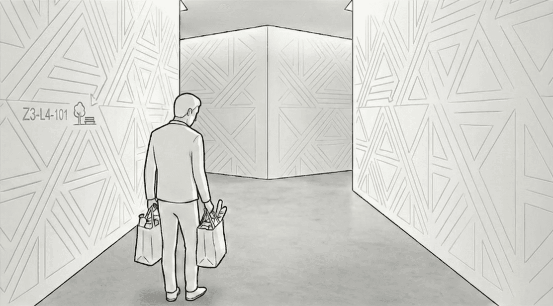
We needed an Analog Address Strategy. Residents must know where they are based on the character of the space without needing a device.
For Tourists
We needed an Immersive Overlay. They require high-tech guidance to find "Anchor Assets" without clogging residential routes.
Images are AI-generated conceptual representations and do not reflect final production designs.

The Strategy
The Tri-Modal Experience: A stratified framework designed to accommodate three distinct user behaviors within a shared architectural footprint.
We moved beyond standard numbering to create an address strategy based on Internal Orientation. Residents navigate via Cognitive Mapping—an address logic rooted in the module's inherent geometry (anchoring relative to The Spine vs. The Void) rather than abstract cardinal directions. This allows residents to identify their location instinctively through the building's structural skeleton.

Device-free mobility.
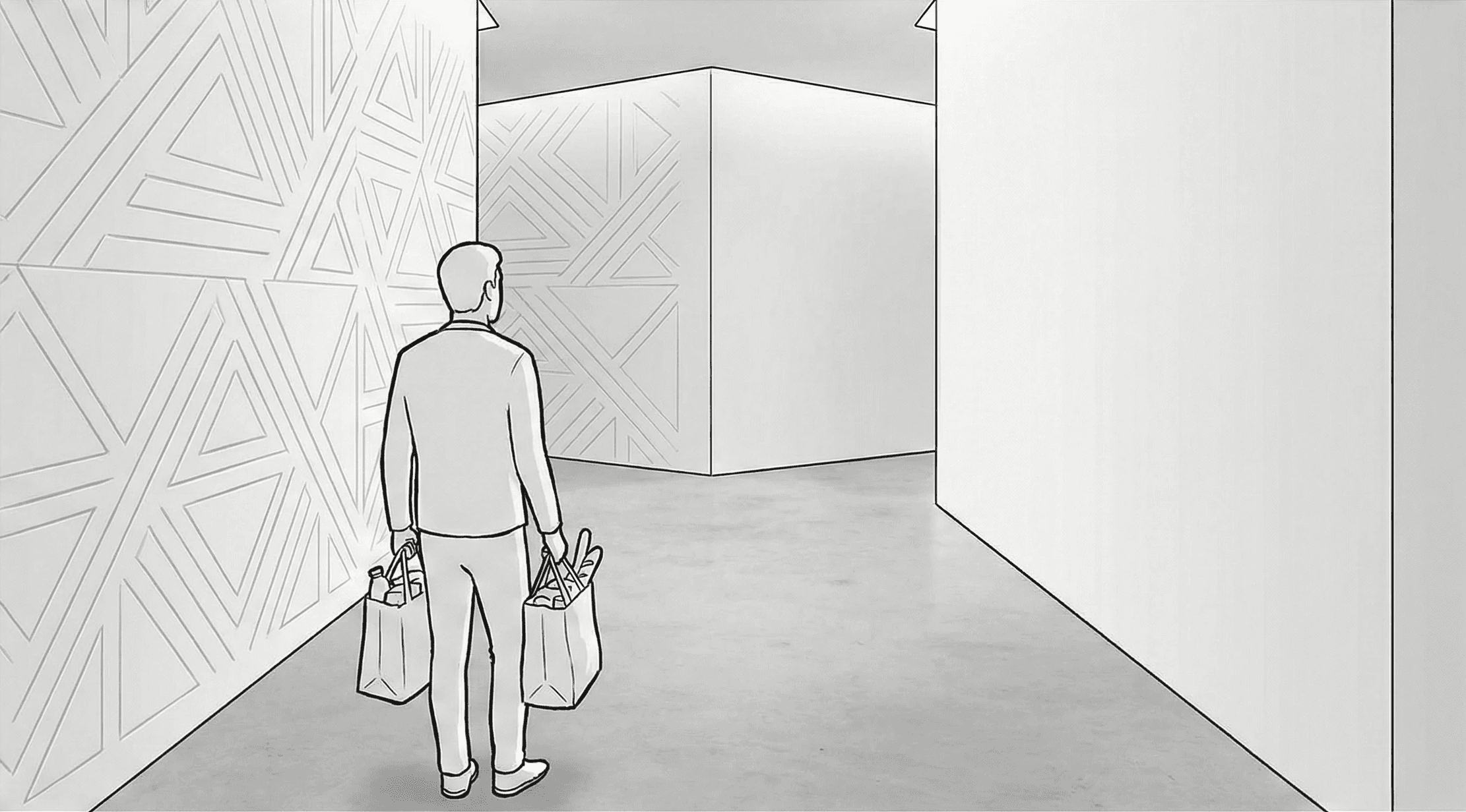
Architecture as Address. The user reads the texture, not a sign.
Confirmation without interruption. Ambient feedback loop.

Success Metric: No thinking required.

Commuters don't need immersion; they need velocity. We designed ambient, physical interfaces integrated into the architecture to display real-time mobility wait times (Metro/Spine) without requiring the user to unlock a phone.

The Planning Phase. High cognitive load.

The Interruption. Breaking the digital trance before Phygital transition.

The Handoff. Architecture and Smart Technology takes control of the flow.

Velocity maintenance. Subliminal cues ensures progression.

As promised by the Cognitive City vision, tourists utilize AR/MR overlays to navigate towards Anchor Assets. We designed specific "Tourist Paths" that optimize for scenic views, keeping them separate from high-velocity commuter flows.

The Tourists lack the resident's cognitive map.
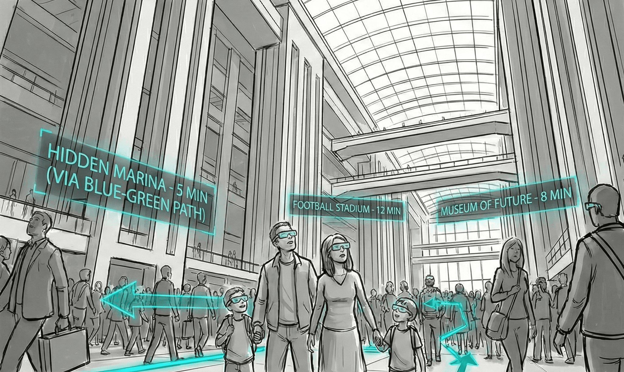
MR Wayfinding. Personalized guidance tailored to their travel plan.
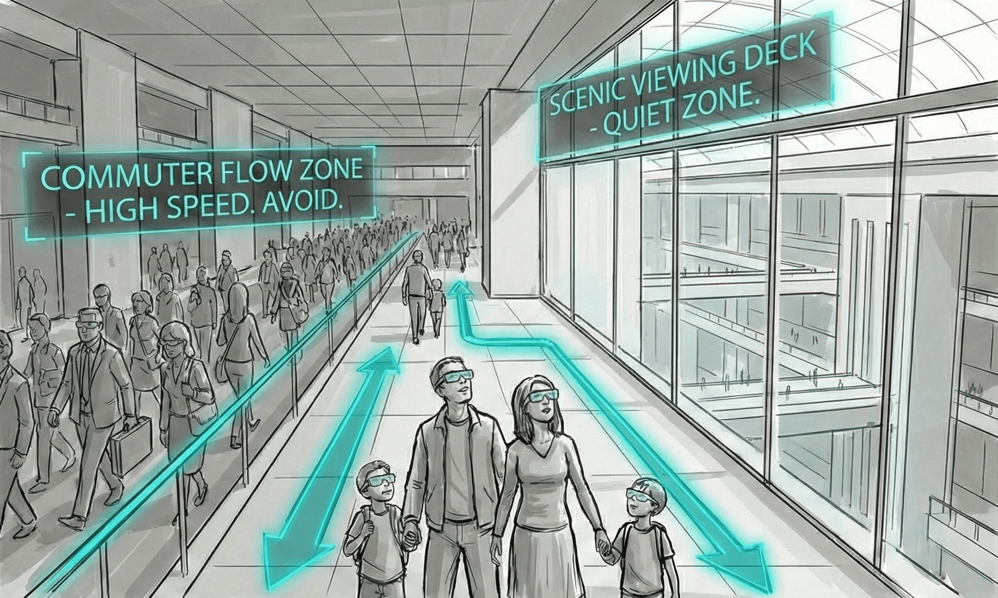
Traffic Segregation. Using digital/physical friction to separate slow and fast users.
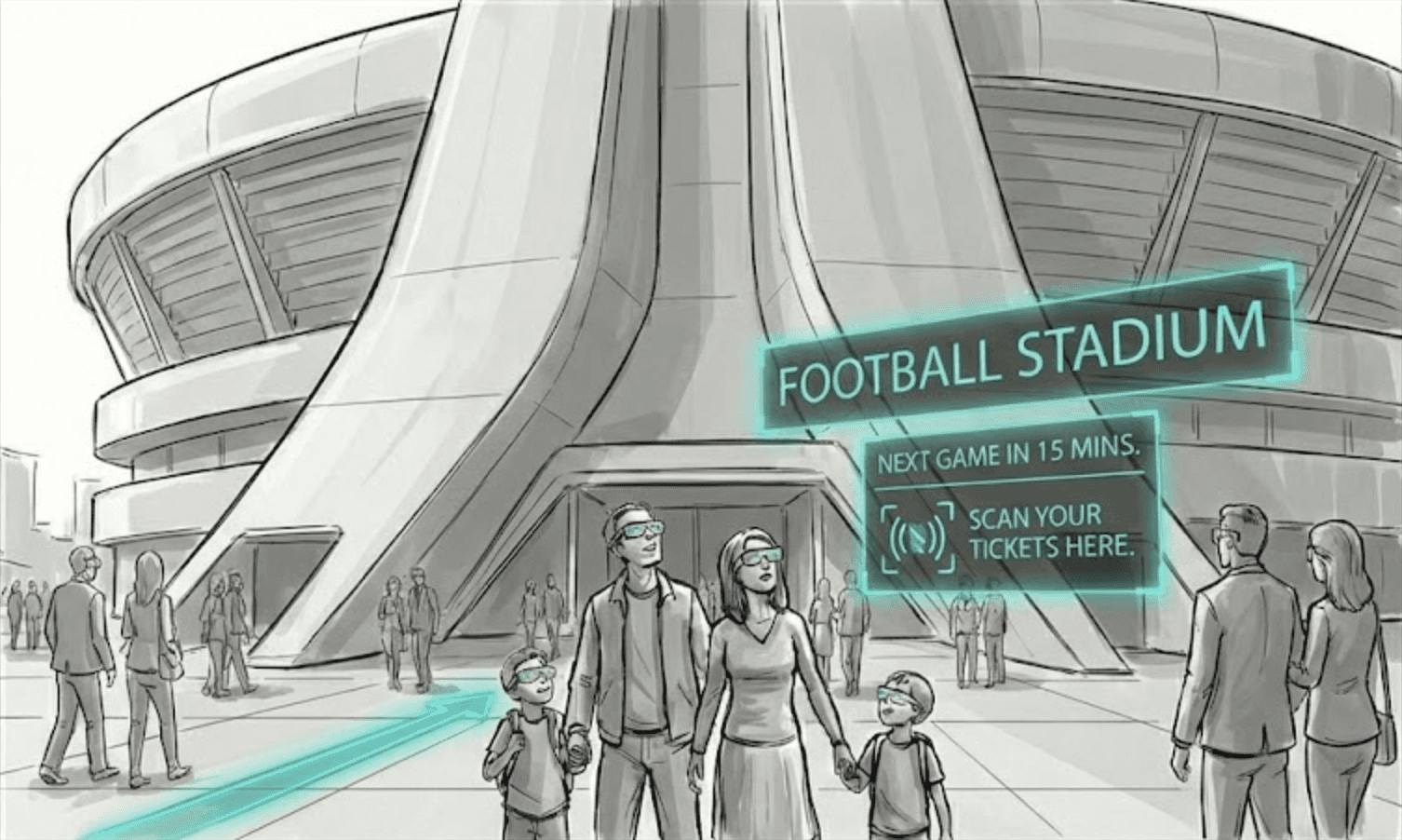
Information Overlay. Wayfinding offers informational guidance.
Execution
Patterns & Symbology as Address
A visual lexicon where specific architectural patterns correspond to specific zones.
Macro-Navigation (Flow): Transit corridors utilize linear, elongated engravings to subconsciously encourage speed and directionality.
Micro-Navigation (Location): Each residential module features a unique "Architectural Hallmark"—a distinct geometric relief or symbolic motif embedded in the walls.
The Phygital Handshake
A layered information ecosystem designed to filter cognitive load
Macro-Layer (Phygital): Architectural surfaces provide ambient, real-time mass information visible to all.
Micro-Layer (Mobile): The user's personal device delivers specific "last-mile" instructions. This split ensures the shared environment remains uncluttered, while the right person gets the right data at the exact moment of need.

The Impact
Cognitive Ease: Enabling residents to navigate a complex 3D space intuitively using "System 1" thinking (subconscious).
Flow Optimization: Segregating Tourist (Slow/Scenic) and Commuter (Fast/Direct) traffic to prevent bottlenecks in a car-free environment.
Resilience: A system where the "Analog Address" (Architecture) remains 100% functional even if the digital network fails.
Reflection
This project challenged me to move beyond the traditional boundaries of Information Design into the realm of Environmental Psychology. I learned that in a hyper-complex ecosystem like The Line, the most effective navigation doesn't come from a screen or a sign, but from the intuitive legibility of the built environment itself. It reshaped my approach to design, shifting my focus from creating visual outputs to engineering human behaviors and frictionless flows at an urban scale.


